Marshall’s project, a largely independent venture, has taken up nearly a decade of his life. Photos by Brent Crane
Lamar Marshall cannot make it over the log. It lays across a small creek somewhere in the Nantahala National Forest outside Cowee, western North Carolina, as a bridge. His problem is a bruised knee, caused by a bang against his home firewood cord. Standing in front of the thick trunk, seeking another way across, he explains that while this particular log was not laid by ancient Cherokees, it does resemble the way they would fell logs to get across creeks like this. “They called ‘em racoon bridges,” he explains. If anyone would know this, it’s Marshall.
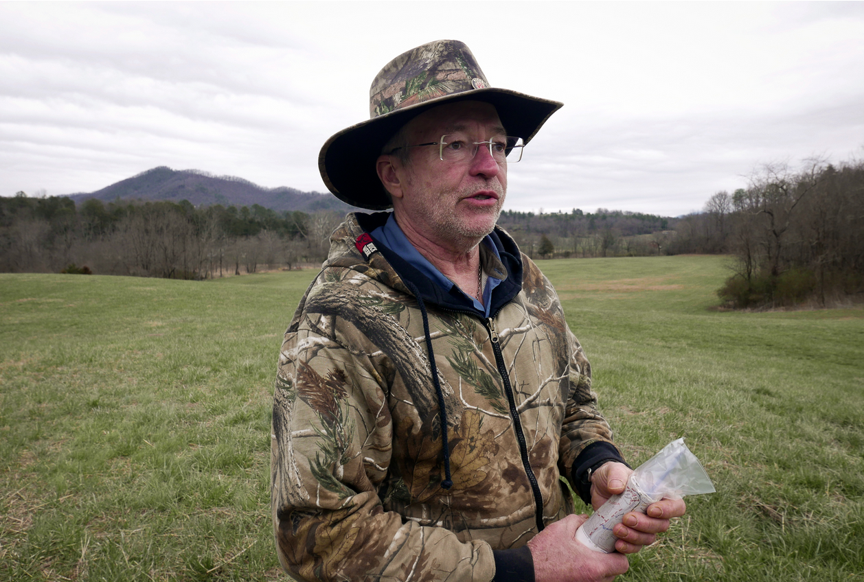
The former land surveyor, electrical engineer, and Alabamian anti-logging activist (in that order), is the world’s foremost expert on ancient Cherokee trails. At 68 he’s stocky, with a soft, even face, like a meatier Billy Bob Thornton, and long eyelashes. He speaks softly, with a southern drawl. In this forest, on a warm late-winter day, he wears spectacles and a hearing aid, but also a camo jacket and pants, a waist-pack stuffed with surveying gear and a pistol. It is often in this appearance, a hunter’s getup, that Marshall has personally mapped well over one thousand miles of Cherokee trails across Appalachia, compiling the mappings into a vast database, complete with historical annotations and Cherokee place names. And his boots are waterproof, he notes, as he carefully fords the creek.

Lamar Marshall
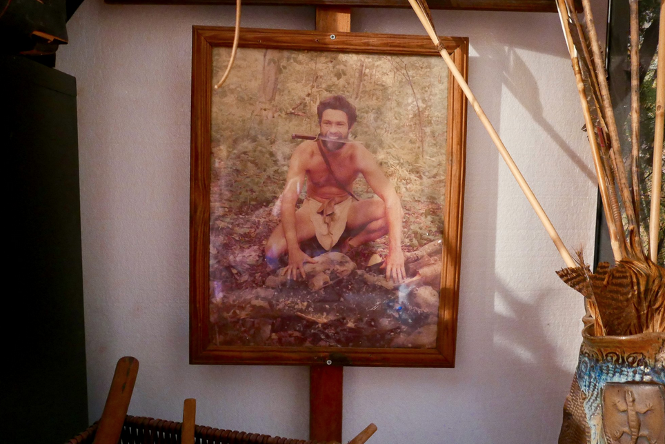
There are certain attributes which are common to Cherokee trails. They tend to follow rivers or ridge-lines. They are often steep. Brett Riggs, an archaeologist at Western Carolina University with a specialty in Cherokee landscapes, equates them with a modern highway system in the way that they linked population centers (some are even replicated in modern roads). Horses, introduced to the tribe in the 18th century, were sometimes used, but mostly Cherokees travelled by foot, in soft-soled moccasins. Inside Marshall’s home there are photographs of him as a young man wearing nothing but a loincloth and these moccasins; he used to sometimes explore the woods of his native Alabama dressed this way. “It was just kind of a fun thing to project myself back into time,” he explains. “I always admired the native lifestyle. Maybe I played cowboys and Indians too much when I was little. I was always the Indians, I know that.”
Marshall’s project, a largely independent venture, has taken up nearly a decade of his life as of the time of this writing in 2017. It is no small feat. He has braved wasps, mosquitoes, ticks, chest-high nettles, rainstorms, hypothermia. Much of the routes are so steep that early Europeans avoided them. Though he has no academic credentials, he scours archives across the country for primary source materials that contain mention of the trails. It is an immense labor but he is nonchalant about his motivations. “I love the trails. I love walking on the trails, camping next to the trails. And feeling like right now: what did the first white people see when they came up here?”
Prior to his trails project, Marshall headed a conservation group in Alabama. He is an ardent environmentalist and near militant in his activism. But while his greenie cred would do well by any Greenpeace tree-hugger, Marshall is also a Republican, gun-owning, bear-hunting Creationist. But if the contrast seems odd, in Marshall’s mind protecting God’s work from the nefarious designs of the state might constitute the very essence of American patriotism. “Wilderness to me is the ultimate expression of freedom,” he says.
Those who benefit most from Marshall’s efforts are modern Cherokees. His work is funded by the Eastern Band tribe in western North Carolina, to whom all the mapping data will go. It will be used in schools. Riggs, the WCU archeologist, is helping Marshall make the maps interactive, with historical storylines and photos. “This is much more than just trails: it’s the ecology of the trails, the geography of the trails,” he says. “They don’t have this history. They just don’t have it.” Indeed, this is the first time that the trails have ever been compiled into a single source. Marshall also hopes to get some of them protected by the United States Forest Service, who he has collaborated with in the past – the North Carolina state is figuring his trail data into their upcoming forest management plan. Marshall plans to be finished with the whole enterprise in September, when he will hand everything over to the Eastern Band tribe. “This will help them maintain their cultural heritage,” he says. “They’re losing that.”
Tom Belt, a Cherokee language expert at WCU who is also Cherokee, describes the project’s impacts on the tribe as unprecedented. Like other native peoples, the Cherokees have long struggled to define their own historical identity and nothing is more crucial to that than landscapes. “It may be a town or a gas station to the United States or the state of North Carolina,” Belt says, “but at one time underneath it might have existed a very extensive culturally-based community that doesn’t exist now. That’s the kind of stuff we wanna know. What was the name of that place?”

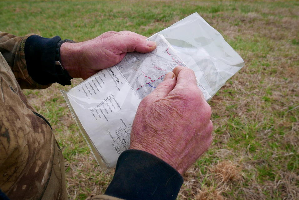
Marshall consulting a topographic map near the Cowee mound.
Riggs, too, believes that compiling all of this data into a single source will prove empowering for the tribe, especially its young people. It is one thing to have a vague notion that some land was once yours; it’s wholly another to see it clearly laid out, and how ownership has changed over time. “When you take some place and you rename it you’ve asserted that, ‘This now belongs to us’,” he says. “If you can, even on paper, reverse that process so that you make it clear that there was a Cherokee landscape here, it gives Cherokee people a conceptual ownership that in many cases they are currently lacking.”
“We didn’t come into a blank howling wilderness,” he adds. “We took over this place.”
On May 28, 1830 the United States Congress passed the Indian Removal Act. It granted permission to relocate Native Americans living in the east to the unsettled land west of the Mississippi. Some left willingly, but the Cherokee Nation – a collection of affiliated communities extending from Kentucky to Alabama – resisted. Conflict had existed for over a century between the Americans and the Cherokees and by now the federal government had grown strong enough to simply take them away. The eventual expulsion, which lasted from 1838-39, resulted in the death of over 4,000 Cherokees. The route over which they headed west is today called the Trail of Tears. Many perished in transit.
Today, Cherokees are found in three quasi-sovereign districts in Oklahoma and western North Carolina. But while most of their civilization was wiped out, burned down, built over or abandoned, it was not erased. Vestiges remain for those who know what to look for: graveyards, earthen mounds, houses, tree carvings; the imprints of a smudged-out, penciled-over peoples. Connecting all of these archeological sites is this vast network of trails, thousands of miles of footpaths trodden over centuries of travel.
And to flip through old maps of Appalachia is to witness the shrinking of a nation played out in faded ink. Treaties often followed conflict and, with each one, Cherokee land shrunk; the younger the map, the less territory is marked as theirs. Events are painfully clear in hindsight.

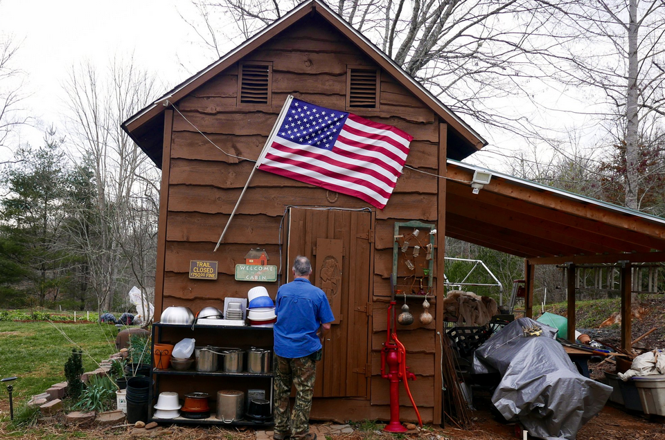
Marshall entering his “man cave” at his house in Cowee, North Carolina.
Marshall keeps these old maps in his home office in Cowee, where he moved eight years ago from Alabama. There is a small desk with four desktop computer screens squeezed between boxes of historical documents: traveler journals, survey plats, three-hundred-year-old land deeds. On the wall is a buck head and a sticker that reads, “I Am Not Ashamed Of The Gospel Of Christ.” Over time the maps get better, too. They are more clearly laid out, with properties divided into perfect squares. Text is less flowery and more legible. Topography is defined numerically. There are fewer and fewer Cherokee towns until there are virtually none at all.
Most of these maps were produced by the United States army. For Marshall’s purposes, they are critical. It is with these frail maps that he locates trails before setting out into the hard world to survey them. He brings one on every hike. He takes notes as he goes, looking to match his observations with any landmarks mentioned on the maps, and marks landmarks with GPS coordinates. When he gets home he plugs this data into his computer and, using GIS software, constructs digital versions. When a trail’s done, he moves to the next.
Marshall traces his fascination with the Cherokees to his childhood in Birmingham (“I hated the concrete, the development”). Survivalist books first exposed him to them. In his eyes, they seemed idyllic. “They didn’t have to go to school. They didn’t have to get a job in corporate America. They lived off the land. They were totally free.”

A photo of Marshall in his twenties in Alabama, dressed in traditional Indian attire.
He joined the Boy Scouts. He excelled. At eighteen, “emulating Tom Sawyer and Huck Finn”, Marshall constructed a raft from oil drums. With two friends, he drifted down the Alabama River from Selma to the Gulf of Mexico. Later he would win a state championship for fur-trapping. His childhood Cherokee interest was reignited by an “old mountain man” named Garvin Sanford who, on occasional forays into the forest for edible herbs, would show him abandoned Indian villages. They would follow the trails to get there.
For much of early adulthood, Marshall worked as an electrical engineer and land surveyor. With his wife and three children, he built a 3,000-square-foot homestead in Blountsville, Alabama. Construction took nine months. Drinking water came from an outdoor aluminum tank; one day Marshall found a squirrel decomposing inside. They raised livestock, fished the river, grew produce. When his only son died at 18 from a heart complication, the family moved to a house in Alabama’s Bankhead National Forest. They had 100 acres. Marshall hung a sign that read, “Trespassers will be shot and survivors will be shot again.” And another: “You believe in life after death? Trespass here and find out.” It was a frontiersman’s existence. For the first five years, they had no electricity.
But living in the woods provided Marshall with an intimate view of Alabama’s dimly regulated logging industry, which “nauseated” the lifelong nature lover. He did some digging and discovered how the management plan drawn up by the Alabama Forest Service had been “developed in collusion with the timber industry.” The tipping point for him came when loggers clear-cut a Cherokee sacred site known as Indian Tomb Hollow, decimating a burial ground. In conjunction with a local clan of Cherokees, Marshall and others rallied against the Forest Service, staging protests, making noise.
Thus, the conservation group Wild Alabama was born (it has since expanded and become Wild South). For over a decade, Marshall’s conservation group wrote petitions, staged protests, filed lawsuits, delivered public speeches, and published excoriating cartoons in the local newspaper satirizing Forest Service officials. This was his “guerrilla warfare” against corporate “tree racists.”

Marshall attempting, unsuccessfully, to cross a log in the Nantahala National Forest.
Marshall describes this part of his life like a veteran remembering war. “I envisioned a band of eco-warriors fighting for the last wild places of Alabama. Native American descendants rose up and we kicked ass for over a decade,” he says (the “descendants” refer to the various tribal organizations which often collaborated with Wild Alabama; Marshall does, however, claim to have three percent Native American ancestry).
Wild Alabama’s member pool represented an odd union of hippies, Indians, and rednecks; with a thick beard, dirty clothes and Cherokee ornaments, Marshall appeared as a hybrid of all three. Outdoor Life magazine called the group “the conservation conscience of a state that has traditionally lacked one.” The group boasted that its members could drink harder and shoot straighter than any naturalists around. Marshall once told a journalist, “Rattlesnakes have got fangs, porcupines got quills, skunks got the sprayer, and God Almighty gave Man the ability to invent the Colt 45 as his defense.”
Marshall approaches a huge earthen mound. It is an ancient Cherokee construction which sits in the middle of a wide empty field. Birdsong rings out across it and in the distance are rounded sloping mountains that are powdered white with snow. At the top of the mound, Marshall points down at the grass and says, “This is where the council-house sat. Here’s a depression that they believe was a fire-pit.”
From up here it is easy to imagine an earlier Appalachia: wide savannas thick with buffalo, the skies crowded with passenger pigeons, dense groves of chestnut trees, the brilliant red-black flash of an ivory-billed woodpecker – all of these species are extinct or sequestered elsewhere in the country. Savannas are gone. Towns are built over. Words are forgotten. There is a new country here. Marshall, in his camo gear, clutching an old map, sounding wistful, says, “The mountains haven’t changed.”